Length: 12.1 miles
Duration: 6.25 hours
Difficulty: Moderate. Well maintained private trails leading to single track forest trail, steady climb with many switchbacks. Arroyo Burro Road is a wide service road accessible to vehicles.
Altitude gain: 2150 ft
Grade: III
View Arroyo Burro Trail in a larger map
The road back into the Upper Oso Campground is still closed after the winter rains, the river crossing considered too deep for all but the most rough and tough cars, so it is a magical Spring of almost deserted natural wilderness.
The kiosk at the end of Paradise Road. If you have an annual Adventure Pass you can park free, or you can buy a one day pass. We drive our mule and horse trailers to this spot and leave them, and then ride on across the river and into the trail system.
The road is currently submerged, impassable to all but the sturdiest vehicles. And mules! Today it was about 2' deep on the concrete roadway. We did previously try to cross in the river upstream but it was WAY deep, and I was in over my knees. That was the point at which Tobe Mule decided to balk, he didn't like the idea that it was looking like his next step was going to get him swimming, and I let him make that call. We walked back to the river road and went across there.
We went along the river on the trails in the willows, and then crossed over to walk through Rancho Oso. This is the first of the horse paddock campsites down by the river. They are a great resource, with room for cars right next to pole paddocks.

After walking through Rancho Oso we walked through the landscape turning sere with the heat, and headed up the Bathtub trail into the cooler forest.
Wild, challenging, and inviting. The ridge crest is Camino Cielo, and it is possible to follow the trails all the way from the river to the ridge top.
At a high point in the trail we can look back across the valley towards the interior of the Santa Ynez Mountains across the river.
An unexpected treat, a waterfall deep in the woods.
The shady trail leading upward. I saw maidenhair ferns, oak, maple, aspen, bay, white sage, hummingbird sage, penstemon, monkey flowers, wooly blue curls, asters, and more wildflowers I don't know the name of yet.
Coming up onto the Arroyo Burro Road, Forest Service Road 5N20, just below the Gun Club. We sped up and headed back down at this point, we could hear gunfire popping and there were shotgun shells all over the road and we didn't want to stay there for a Mad Max Mule Moment.
That tiny white bit in the green between Tobe's ears is Rancho Oso, 3 hours below us.
Tobe posing for a portrait, contemplating the splendid vista of the Santa Ynez mountains.
Whatta guy!
The trail update from Rancho Oso says that the Matias Trail is currently washed out from the winter rains, but we took note of the route and made a pact to explore it soon.
This sign has been there for DECADES, mute testimony to the guy who cut the letters out of the metal and didn't think about the fact that the metal post welded behind it would obliterate the B in Burro.
The sign for the White Oaks Camp, used by the exclusive all-men's Santa Barbara Trail Riders.
A ride from the end of Paradise Road, across the Santa Ynez River to Rancho Oso, then up the canyon on the Arroyo Burro Trail, and back down on the Arroyo Burro road. In the front country range of the Los Padres Forest in Southern California.
Length: 12.1 milesDuration: 6.25 hours
Difficulty: Moderate. Well maintained private trails leading to steadily climbing unobstructed forest trails.
Altitude gain: 2150 ft
Grade: III
Trail sign for the various routes around the Santa Ynez river. The trails are well marked, and very under used, so the Los Padres National Forest remains a resource open to all and accessible with just a little effort. I for one have a goal to explore and document as much of the area trail system as I can.
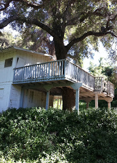
The clubhouse at Rancho Oso with the deck built around one of the magnificent oaks. A lovely place to end the day's journey and plan to return.


