An enjoyable opportunity to ride on the 30,000 acre Huasna Land and Cattle Company private ranch out East of Arroyo Grande, participating in a fundraiser for the San Luis Obispo Parks, Open Space and Trails (SLOPOST) Fund, supporting trail maintenance in and around San Luis Obispo County.
The Serious Endurance Riders were there to ride 25 or 50 mile loops each day.
My Charro Compadres and I were completely happy to do the "Introductory Ride" of 10 miles. Or 9.2 miles. Whatever.
In order to do that, we loaded up our animals in the pre-dawn dark.
Tobe in the MuleBox, and the four horses split into two trailers.
And off we set to drive 110 miles to trail ride 10.
Well, actually, we intended to go on the 10 mile intro ride, but I had two electronic mapping programs running concurrently and while one showed us going 9.3 miles the other said 10.5.
For the people who take this sport seriously I'd think this would be a real issue, they tally up their miles ridden each year and push themselves and their animals to ever greater distances and achievement.
We just went to see a new trail.
Which meant we drove up the coast to Arroyo Grande and then turned inland toward Lopez Lake. The road goes through wonderful rural countryside, hardly feeling like California at all.
As the sun rose we were heading for adventure, with me in the lead hoping I was accurately following the directions..... on a road that dead ends into ranches, and so is very little traveled.
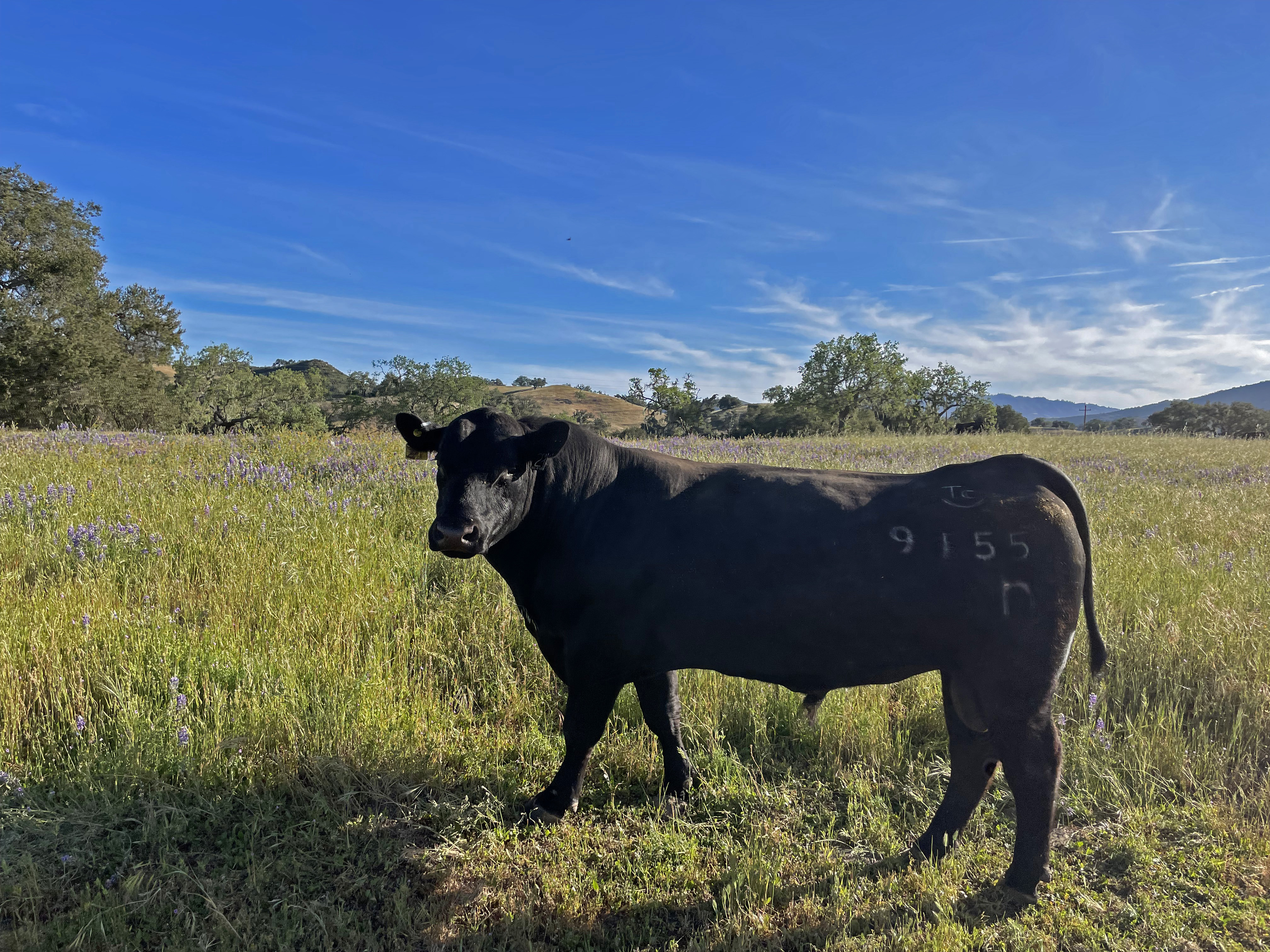
The directions, which did say "watch for bulls on road", were accurate.
The bulls were the locals, we knew we were on the right track.
And when we came to this wooden bridge that required careful slow driving on planks, things were getting seriously Western.
More locals, and a hard left, and we were almost there.
Then we checked in, signed forms, met up with Stormy, the Trail Boss for the Introductory Ride (which was just us) and we were ready to go.
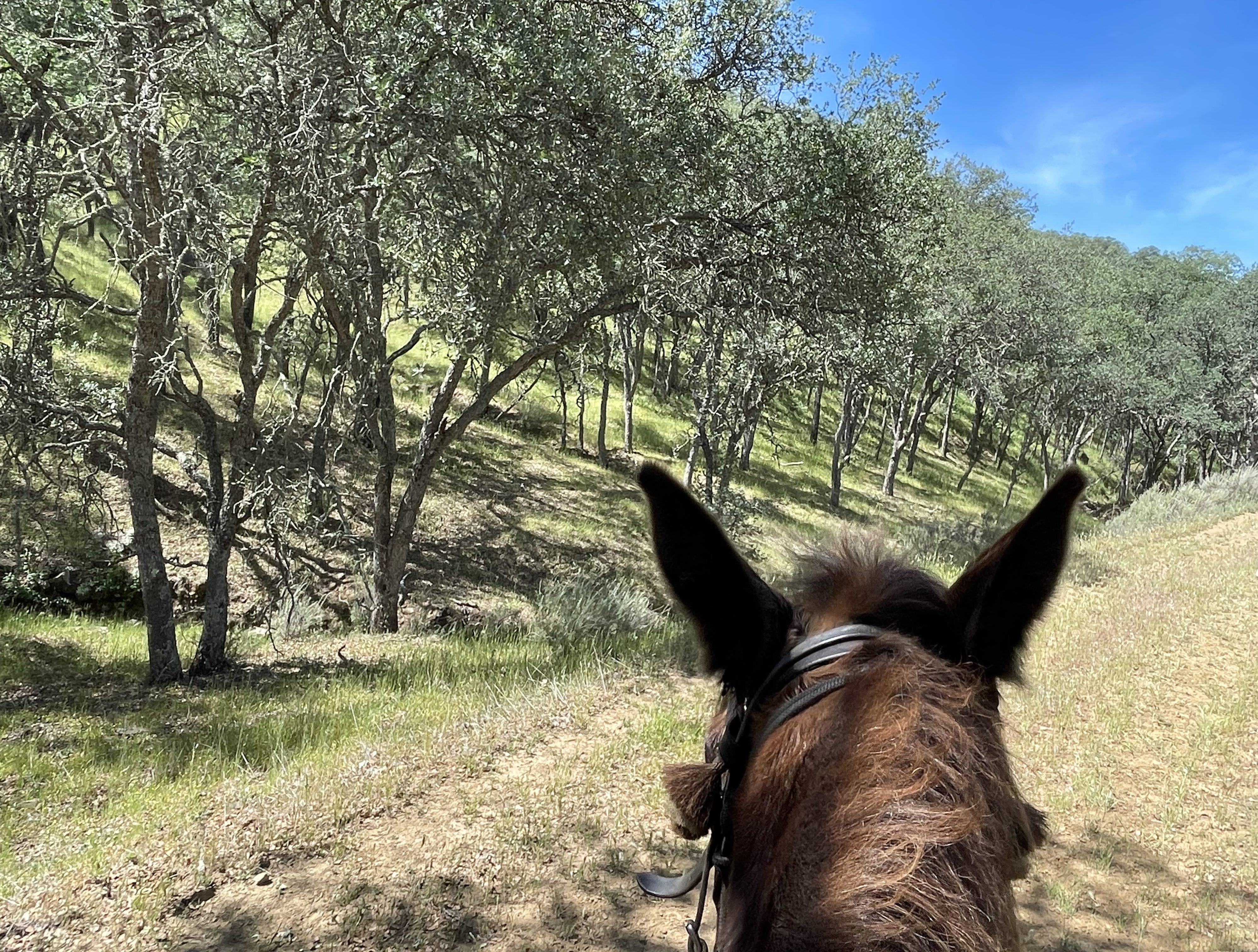
Tobe Mule and I looked and looked, but we didn't see any other mule teams.
Ah well, we like horses too.
And off we went.
Endurance rides like this, with 100+ participants on hot blooded Arabians and other competitive horses, require lots of planning and preparation to run smoothly. Hats off to Kathleen Phelps and the other organizers who worked so hard to secure the property permission and to make sure nothing untoward happened during the weekend.
Down the ranch road we went, and entered our first gate to begin our exploration.
Tobe and I know these guys and their horses well, so that made the day all the more special to be spending it in the company of friends.
I don't know anything about this property except that it was once a Spanish Land Grant, so I'm guessing this might have once been a cabin that has collapsed.
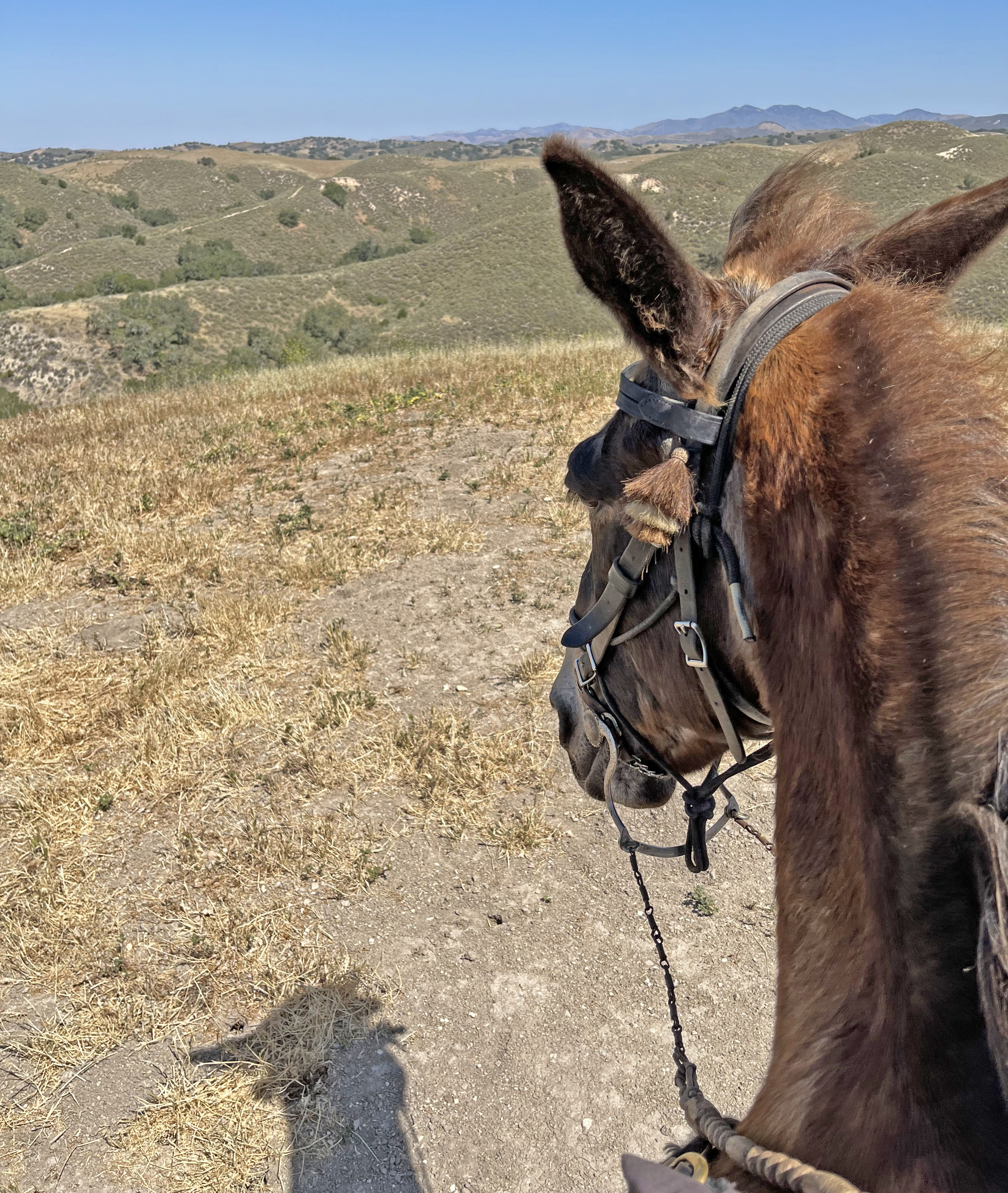
When we came to another gate by unanimous decision all of us older folks decided that Rodrigo, Arturo's son, was by virtue of his youth the gate-opener. This gate was an actual metal pole gate, but many of the others were just barbed wire stretched on sticks that required dismounting, moving out of the way, and then replacing. Let the 18 year old do it!
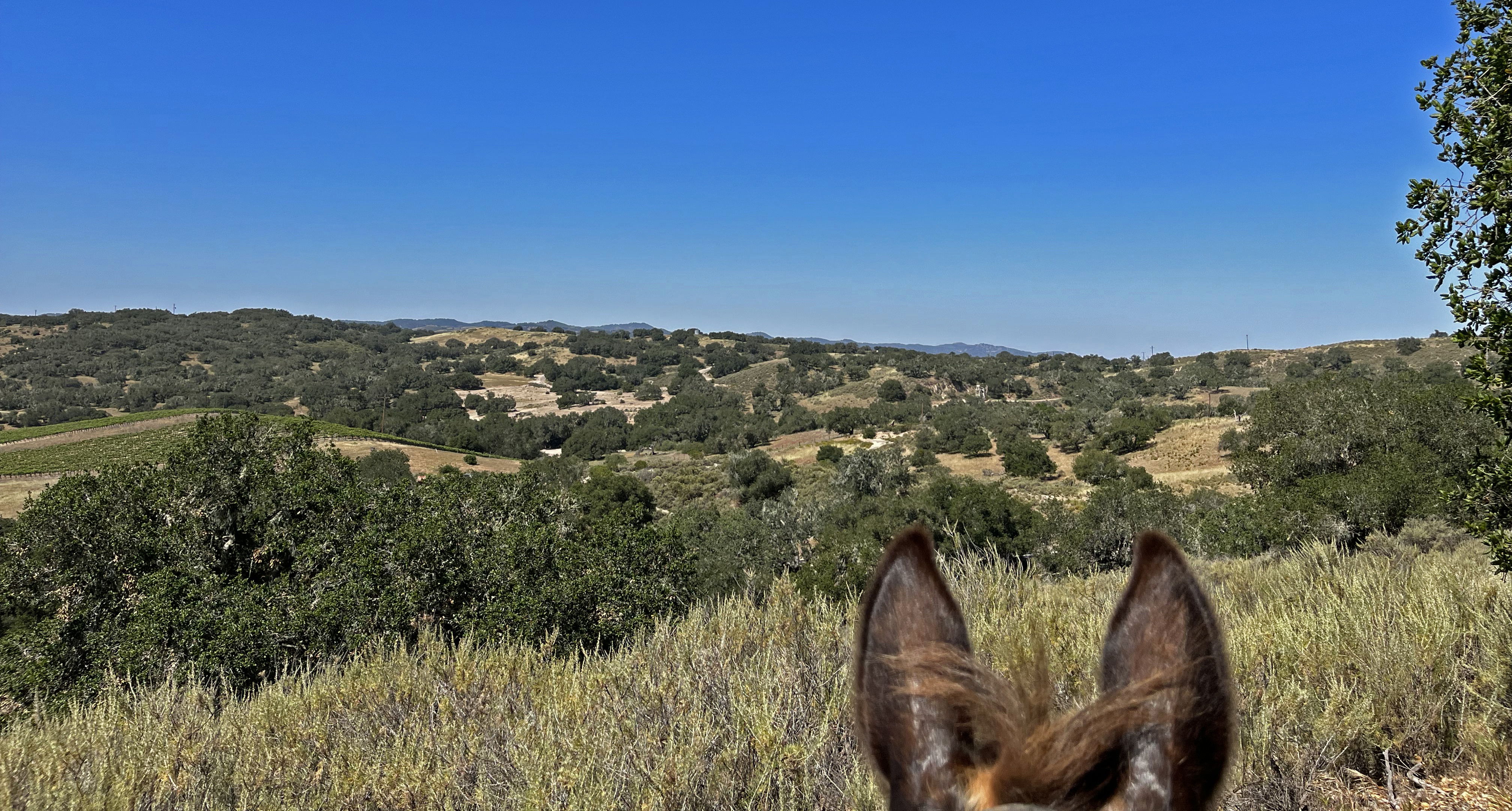
Almost immediately we started to climb, climb, climb. If you scroll back to the third map at the start of this blog you can see a red elevation record, and see how we headed straight up and out of the valley where the competitors were camped.
WAY down below there are all the LQs, "living quarters horse trailers" that are the requisite for the human and equine athletes who travel long distances to compete in this sport. Most of them are longer than my house, a fact that never ceases to astonish me.
Looking toward the West the chaparral and oak woodland is quite different than what we are accustomed to riding in the mountains near Santa Barbara.
Looking toward the East gives the same sense of vast space that we get in our usual trails. Now THIS is the antidote to staring into a computer or bending over an intricate tattoo. Nature as balm.
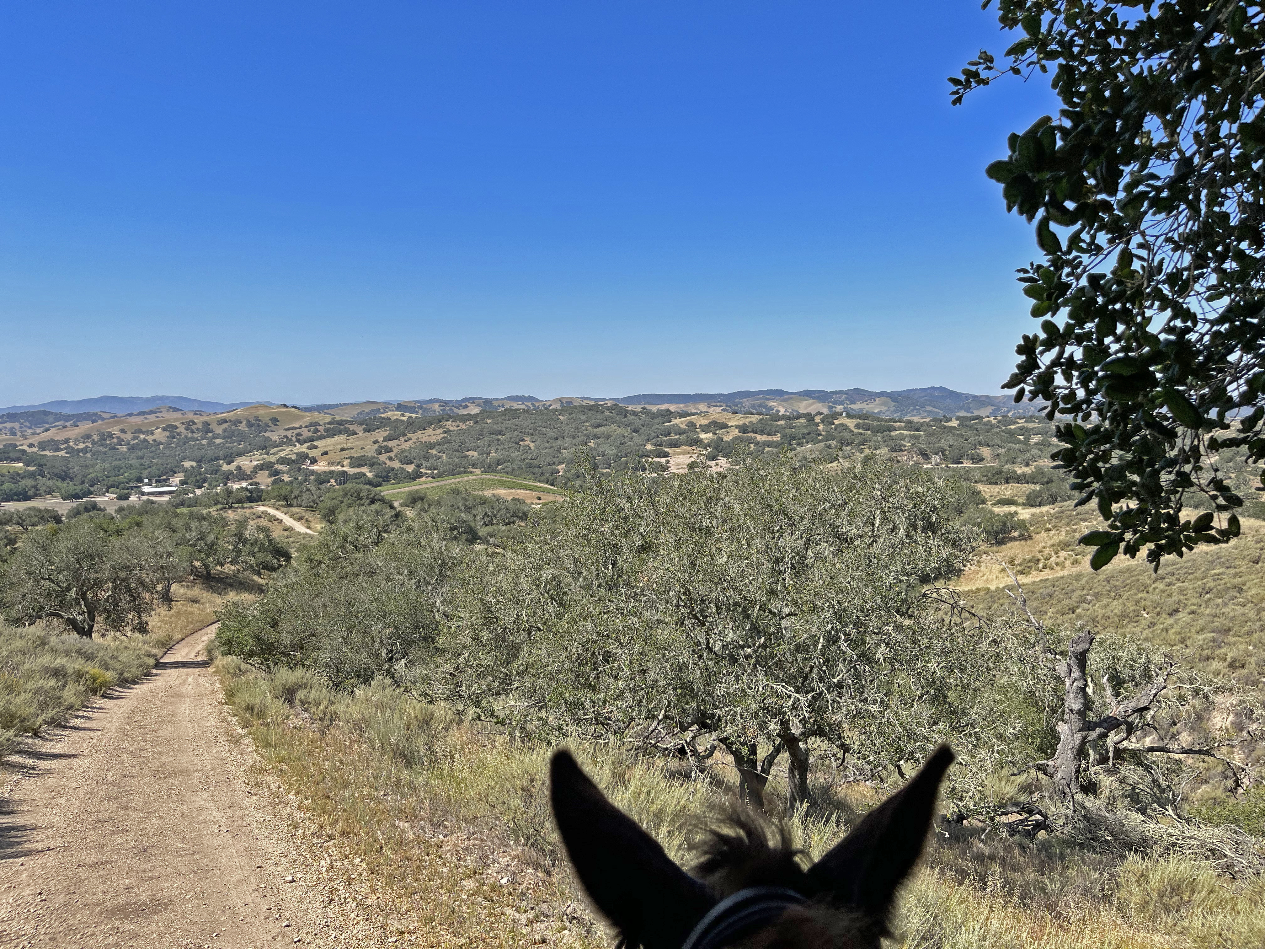
Looking East we could see a road winding its way, but more striking were massive power lines. Tempting to think that the electricity for the city of Arroyo Grande comes from somewhere far inland on these cables, but I do not know. They are a striking contrast to the trees and hills.
I asked my pal Arturo to pose here, such a lovely backdrop. Often on rides like this Tobe Mule and I bring up the rear, especially if the others are riding stallions. SO I always appreciate when one of the guys is gentlemanly enough to walk with the Mule Team, at the mule pace.
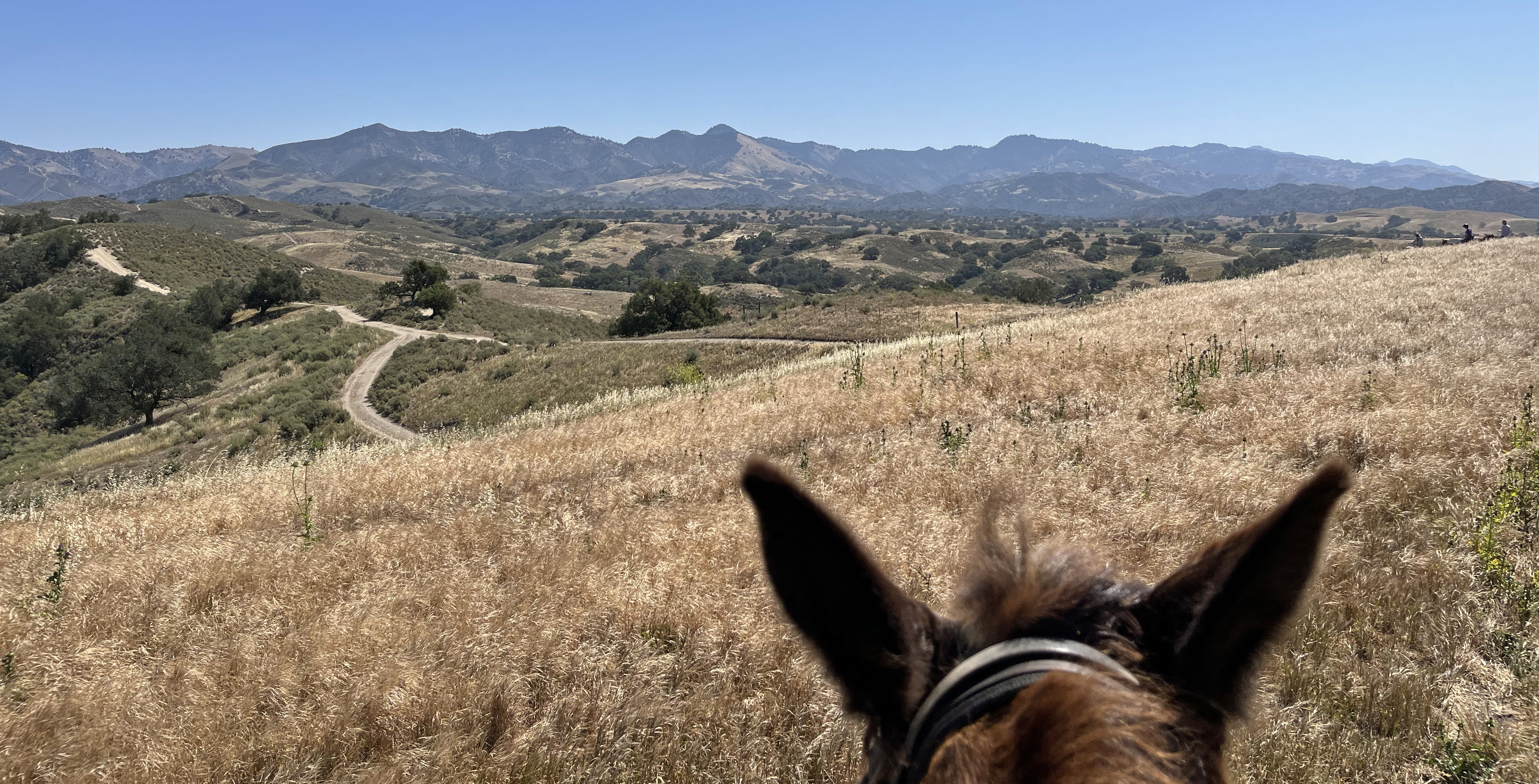
The wind started to pick up as we approached what looked like the top of the hills. The view kept getting more elevated.
And the plant communities were changing. Here were plants we'd expect to see in coastal sage scrub lands.
But turning up the trail it looks like oak woodlands. Almost manicured, and still holding on to the last green of spring.
This is the trail marking system we followed. Yellow delineated the introductory ride, and there were at least 4 other trails marked with different colors of ribbons, a 25 and 50 mile for each of Saturday and Sunday. Plus we had Stormy leading us, who had ridden it the day before.
Can't you hear the soundtrack of the spaghetti Western as these guys come riding up over the crest?
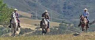
The Good, the Bad, and the Ugly, not necessarily in that order.
The trail was really ranch roads, so nothing technical, and probably most frequently traveled by cowboys in pickups.
But easy to imagine the vaqueros who first tended cattle on these vast acres, moving across the land for work as we are now for pleasure.
We came to a nice view with the valley and mountains in the distance so I asked everyone to pose for a souvenir photo.
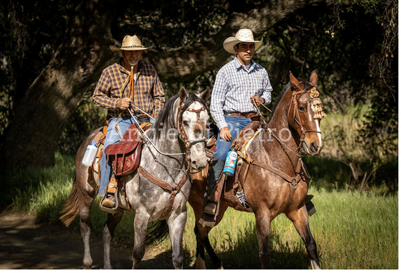
Arturo Medina Espinoza on his dapple gray Pistola.
Gabriel Contreras Hernandez on Señor Cremello
Rodrigo Espinoza on Relampágo
Noe Peña Alvarez on Marcos
Stormy Doreen Lopez Knight on Pico
and of course Pat Fish on Tobe Mule.
What a krewe!
And what a day, wending our way through stands of oaks, and coming upon new views.
Now, there WAS a reason I had TWO tracking apps running in my iPhone.
Usually I rely on GaiaGPS to make a nice map of where we went after the fact, unobtrusively humming along in the background communicating with a GPS satellite making the waypoints and map.
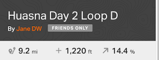
But for this ride I tried out RideWithGPS because the organizers had uploaded the Track for "Huasna Day 2 Loop D" and encouraged me to have it in my iPhone as well. And thank goodness I did. Three times our Trail Boss started to lead us off into the wilds, a wrong left instead of a right, and the magic app would bleat out an error sound, insisting we backtrack and get on the correct trail. Without it we might still be stumbling around the 30,000 acres!
Whether vernal pool or watering hole we could not tell, but the trail took us past this body of water.
In drought times it is nice to see the animals have water access.
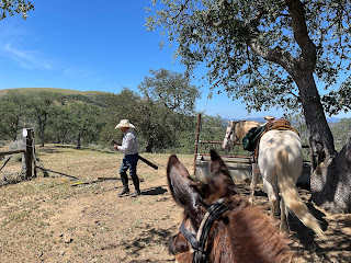
One last gate that Gabriel dismounted to open and shut for us.
And then we could see the campsite below us and we knew our trail was coming to an end.
And the nice volunteers were there to check us off as we completed our trek, and compliment us on a ride well done.
And we were ready for a lunch and then load up and head for home.
A professional photographer who lives in the Huasna Valley named Angie Di Pietro took these last photos of us as we headed out, so I will finish up the blog with her wonderful portraits that certainly capture us.
Hasta La Vista, Huasna!
"Happiness is a choice that requires effort at times." - Aeschylus
##### PAT FISH #####
### FIN ###