The mountains that form the Gaviota Pass, bringing Highway 1 out to the Central California coastline above Santa Barbara.
We begin this ride at Las Cruces, where the 1 and 101 split. Some of the trail is rough and washed out and untended, some is access roads. All is beautiful.
When
we rode here last month it was socked in with maritime fog, and today we wanted both to escape the heat on inland trails and also to be in cool coastal breezes. The sun was just peeking through clouds as we tacked up.
There is a nice equestrian parking lot by the school, so we were able to saddle up the animals and head on out.
For this ride we had 5 riders, and we went through the gate
and crossed into the trails
and prepared to see what there was to see.
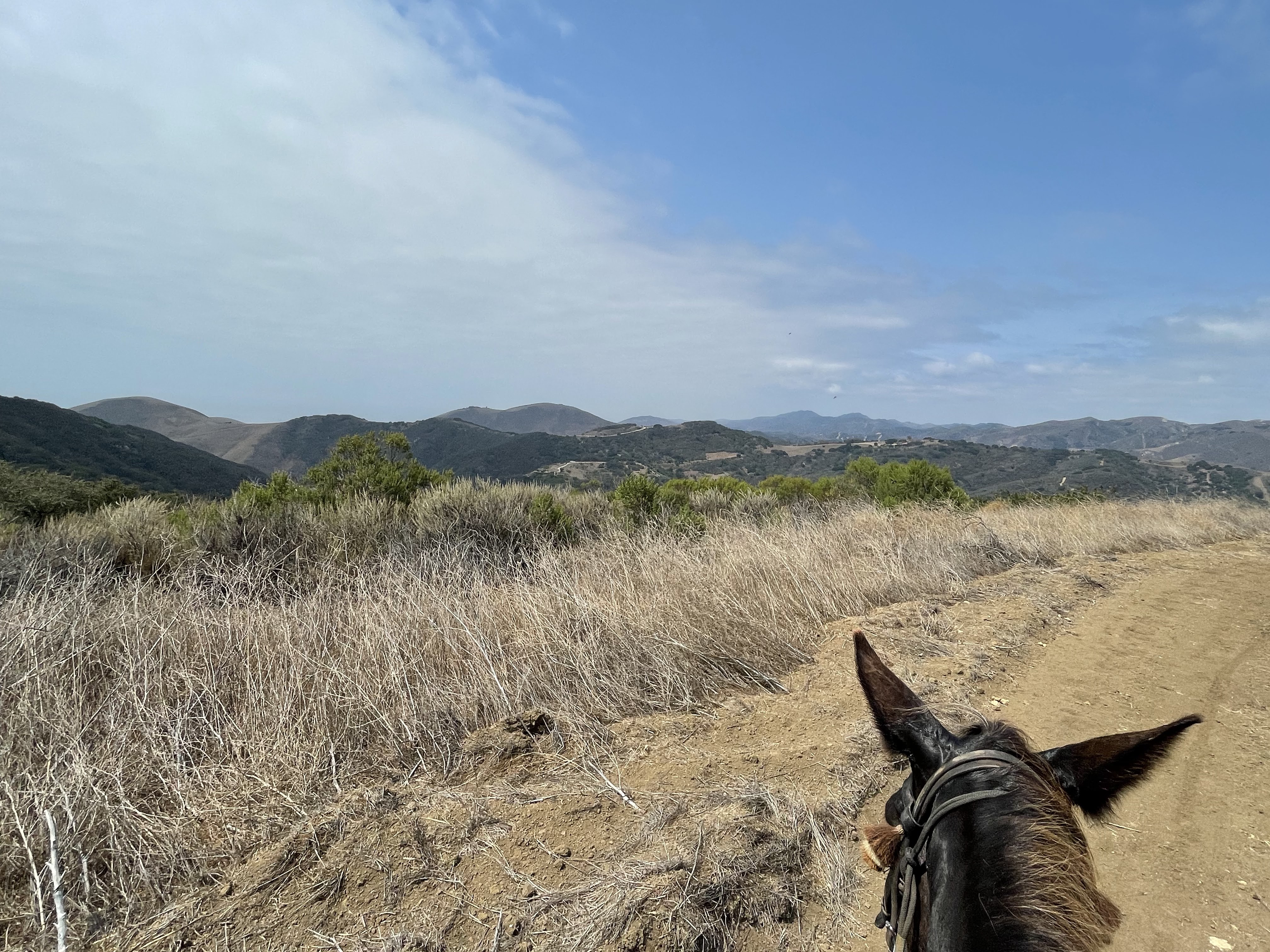
As soon as you get onto the trails the mountains loom around.
Traveling through this pass always requires skillful driving at highway speed, and doesn't leave much time to gaze up at the beautiful surrounding land forms.
We all loved this trail system the last time we came, and my idea for today was to do the same route in reverse.
That always gives entirely new perspectives and views.
So we checked the kiosk map and then headed down the Ortega Trail that runs along and above Hwy 101/1.
The first part of the trail is quite open, threading the way through the grassy hillside.
But what keeps it interesting are the changing horizons, as the views of the nearby mountains pivot as you angle around them.
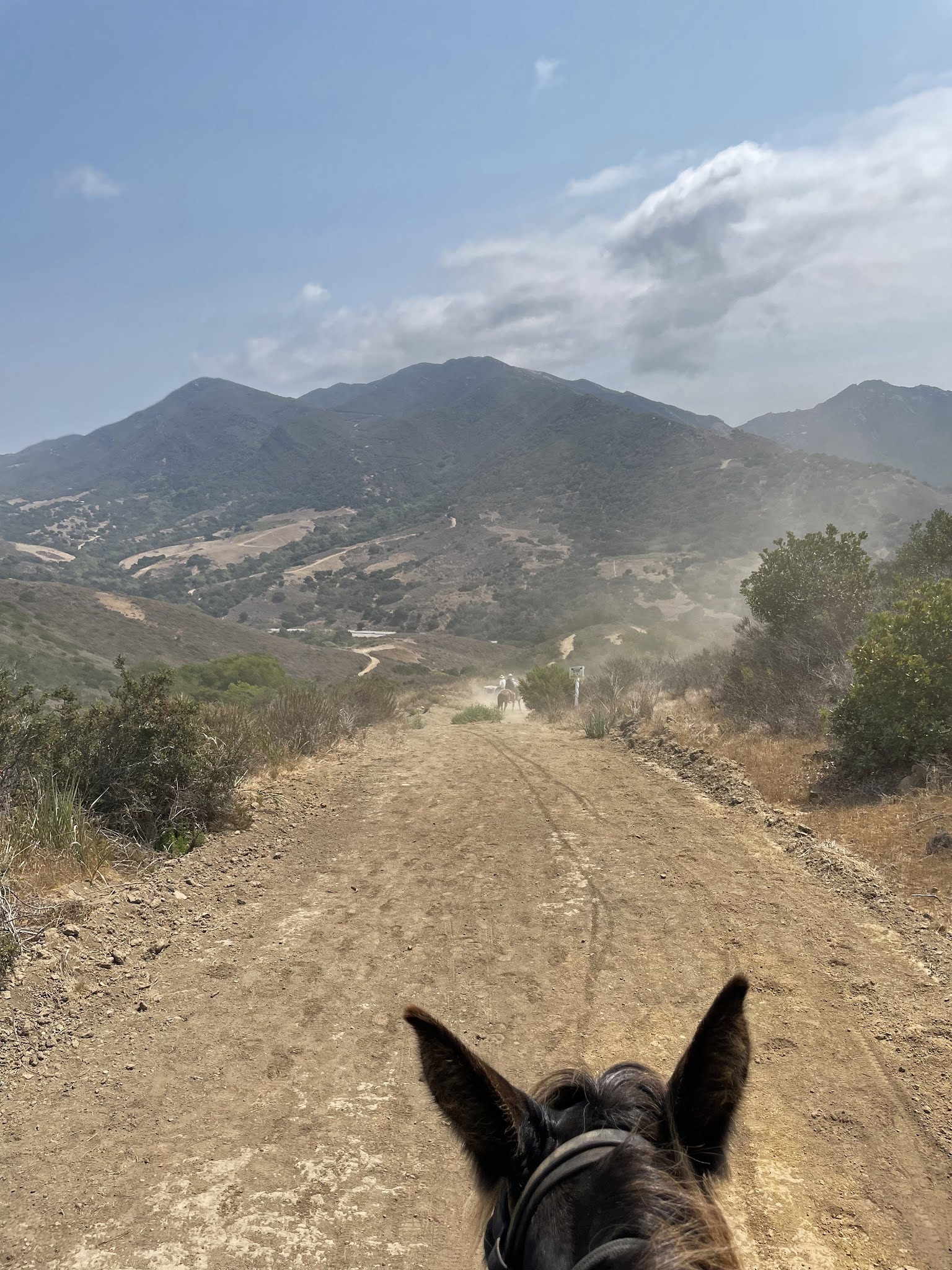
There, straight ahead, is the slow-down-curve, and the sign that offers the mythical Rest Area that is always closed.
Now, very soon after this we hit The Rough Patch. It is never so hard to go uphill on washed out and rocky trail, the animal does all the work and you lean forward and say encouraging things as they find their way.
It is a whole different event when the very steep trail is gullies and rocks and big rain-gauged cracks in the middle of the trail. Suffice to say I was holding on and did not pause to take photos through this area.
But soon we were back up onto one of the wide access roads that make up the majority of the trails here, and all were breathing a sigh of relief that we made it through what we knew was the most challenging part of the day. Having gotten it out of the way first.
Now the road was broad sweeping curves, easy going for all.
But looking back the mountains made such a lovely tableau we stopped so I could take some souvenir photos. We are all, of course, quite dwarfed by the landscape we are in.
Jamie & Mosca
Deni Lee and GiGi
Terri & Renegade
Pat & Tobe
It is always a pleasure to have photographic memories of our rides, everyone is glad of them.
I noticed that many of the areas we passed by one month ago that were lush and vibrant masses of red poison oak are now visibly diminished, withering in the summer heat.
Even Tobe who likes to snack on the itch-inducing leaves passed them by.
By this time we were getting pretty high up on the Hollister Trail, and could look back across the distance we had climbed.
And FINALLY we could look out to sea, across the Hollister Ranch lands. But admittedly there was enough haze and so much land betwixt that there was no vista of crashing surf or sparkling waters.
From the
Hollister Ranch website: The rambling 14,000-acre Hollister Ranch is located behind 24 hour
guarded gates on a working cattle ranch. Each of the exclusive 100-acre ocean view properties offers the
ultimate in security, privacy and solitude.
From
Wikipedia:
Hollister Ranch is 14,400 acres (58 km
2) of fallow and fertile fields, mountains and valleys along the
Gaviota Coast in
Santa Barbara County, California between
Gaviota State Park and
Point Conception. The area is some of the oldest known human settlements in the new world, the last native population of which was the
Chumash. The land was purchased by
William Welles Hollister after the Civil War.
But what need have I of prestige land, when I have a mule who stands so still on command that I can take a panoramic!
As we ambled along the road we could look down at the estates of the 1%.
Like so many places we ride, the view shows how much of California is undeveloped.
In this case it is tightly controlled and private, and anyone wanting to actually go onto the Ranch has to be invited.
Or, like the surfers, sneak in by boat.
Soon the road turned, and we started to angle back toward the pass and the 1/101.
Looking across the highway I was struck by being able to see the trail we once had ridden going up the mountainside to the Peak.
This is
where we rode last Christmas for the last ride of the year 2020, tracking from the Gaviota Hot Springs parking lot on the 101 up to the Gaviota Peak.
It is hard to see the trail in this photo...
So I blew it up in Photoshop.... it tracks all the way up to the peak and then extends South-East to become Camino Cielo that follows the ridge crest all the way back down to Santa Barbara.
Speaking of tracks,
we saw lots of skid marks of bicycles in the dirt.
And we did encounter two older men on bikes who were very pleasant and courteous and waited for us to go by. We also saw one trail runner and one guy with a dog.
Amazing that a property as huge as this is so little visited and utilized.
We felt blessed to explore through it.
Now that we were descending in altitude we were back to views of the highway below.
This is an archival photo of a stagecoach in 1860 traveling through the Gaviota Stage Road, which later became the highway.
This is an illustration why Tobe Mule and I like to stay a ways back from the pack when on a dusty trail.
And here our compadres pose for us, on the home stretch down the hill.
One last aerial of the Gaviota Pass, which soon will take us back to civilization.
But first there is time for the animals to get stripped of tack, and Tobe can have a well-deserved snack of carrots and hay,
while the humans share a lunch and congratulate ourselves on a trail well traveled.
"Don't try. Just do it."