Saturday, October 13, 2018

2018/10/13 Aliso Loop and Oso Canyon


The Aliso Loop trail has been closed for some years, and now that it has been reopened we went to check it out, pre-riding for a group who will be camping in the area in 2 weeks. Visible on the map are the several false-trails we went up and then turned back, finally deciding to start our trail by going up Oso Canyon on the right, and then crossing over to come down the Aliso Loop ridge.
A journey of 2.5 hours and traveling 6 miles, gaining 800 feet in altitude, much of it on single-track trails that test the fortitude of both equine and rider.

We started in the parking lot at the end of Paradise Road at First Crossing.
I was remiss in thinking that it had an attendant at the kiosk, and so our rigs would be safer from vandalism. Nope. A $10 fee is required and our 3 rigs were the only vehicles present, on a beautiful sunny Saturday in the heart of nature.


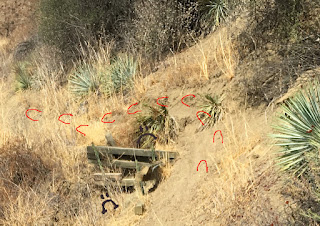
Tobe was more snorty and anxious than I've seen him in ages.
He kept looking up at that escarpment and trying to let me know something was up there he did not approve of.

As much as we humans squinted we could see nothing.
We knew, of course, that we were going to be on that very ridge later on during our ride.

This is the Santa Ynez River, completely dry, choked with reeds and willows.  After trying to find a pathway along it to start our ride by going over to Sage Hill Campground and then UP the Aliso Loop ridge,  we turned to the old faithful trail and went up the Oso Canyon.
We opted to take the access road into the canyon instead of the usual trail, just because I hadn't done that before.


But of course that wasn't nearly as interesting as being on a trail.


It is a multi-use area but today we saw only two women on horses, four hikers and one guy walking a bicycle.


On wide open trails like this it is easy to share the trail, you can see them coming!

And Tobe Mule's ears hear them long before a human perceives any presence.

He also never forgets any trail detail, so if we come to a spot where we have previously seen a deer he looks over there intently, remembering it quite as much as I do.

The burned trees still stand testimony to recent fires, and the oaks lining the trail are not being trimmed for passage. So at times we bash our way through branches and in one spot must blaze a new trail around a fallen tree.
At Upper Oso Campground we obeyed the speed limit, and were pleased to see quite a few rigs parked throughout the camping spots.
At the top of the campground a sharp left turn puts us on the Aliso. Directly forward used to be the trail to 19 Oaks, still closed as too dangerous.
And looking up the Aliso it is a daunting height,

Which would be OK except for sections like this wash-out. The sketchy wooden bracing is tenuous at best, and in order to continue on the trail it is necessary to walk up onto the extremely steep hillside, using some young Yucca whipplei for support. Of course I am riding an all-terrain Mule, but even so we did it quickly lest it give way beneath us.
But it leads to views like this, where the dramatic play of light and shadow from clouds overhead make the landscape an ever-changing display of colors.
This panoramic was taken from the same spot as the previous photo.
Tobe mule was tired, he stood very still!

I decided it would be a good place to take souvenir portraits of my companions.

 Jamie Buse and Mosca the Thoroughbred horse fly
Paul Jacques and Pancho the Quarterhorse
And there's me on Tobe the Rocky Mountain Mule

And then it was back traveling up again.
If you're not the lead dog, the view never changes.

Simply amazing that this dramatic landscape is 45 minutes above Santa Barbara and unknown to most.


A typical example of government foresight.

This sign is supposed to mark the divergence of the trail, above is the Aliso Loop, to the right the Aliso Canyon. Since no one thought about how it would be mounted on a pipe, it now says ALISO OOP and ALISO YN.

Worse yet, there is no notice that the canyon has a long section of shale that is extremely difficult, dangerous, and is preceded on both ends by a single track trail no more than 3' wide, quite difficult to turn an equine around on should you see that shale ahead and wisely decide to retreat.

Finally we reached a point where we were at the top of the ridge, and could look down at the next stretch, the descent back to the river level.
One last look back through the chaparral bramble at the terrain we have covered, then it is time to start our descent.

Looking down we can see the rigs in the parking lot. Now WE are up where Tobe thought he saw something dangerous earlier in the day.
This next section of the narrow trail was steep switchbacks, with a vertical drop-off on the side. NOT a place I was going to take many photos.  And while I know that holding my breath doesn't help at all it is very hard not to. It is a bit like the ride into the Grand Canyon, you just gotta trust the mule.
And finally we were down to the place where the canyon and loop trails diverge at the bottom. Once again, no warning posted, even though the locals know not to ride it. Riders we met said they'd gone up as far as the shale and turned back.
The pucker factor on a trail that narrow with a drop off is memorable.
Then it was time to turn left at the bridge to nowhere and head over to where the rigs were parked. Since nothing else exists of this monumental cement structure except for this one support, and no credible legend explains it, we might as well consider it Modern Art.
And here we are, Pat Fish modern Artist, and Tobe Mule, modern Mule, caught while in the midst of recording in photographs via iPhone these FrontCountry Adventures.

"Don't listen to anyone else
Focus on your passion
Burn it with your glance
Become the Dinosaur."
-  Ray Bradbury 

#####FIN#####PATFISH########


Saturday, October 6, 2018

2018/10/6 Elwood Mesa and the Devereux slough


A beautiful sunny day and a triumvirate of riders took the opportunity to explore the recent changes to the terrain around the University of California at Santa Barbara campus.
We rode for 2 hours and covered 5.5 miles, glad to be out in the fresh air.


Every ride starts with the tacking up. The animals ride naked to the meeting point, and then patiently wait while they get saddled and bridled and readied.

Tobe takes longer, mules have significantly more gear, so I appreciate that my riding companions are patient with us.
And Tobe, in turn, is patient with me.
I genuinely think he enjoys exploring around, and also my mentors assure me that he forgets nothing. So he remembers this trail quite as clearly as I do.


But oh my gosh,
last time I rode out from here this was a big open field leading up to a golf course.
Now it is crammed full with cheap clapboard housing.
A distressing loss of open space.
And almost immediately we start seeing the signs.
This was a beautiful trail meandering through the eucalyptus grove, connecting to the Monarch Butterfly Preserve. Now it has been deemed too dangerous to travel through. The years of drought have taken their toll on the trees, and rather than selectively thin and trim them the Government has chosen to forbid public access.
And the massive Venoco oil and gas storage tanks are still here, even though it was my understanding that they had withdrawn from processing oil here and were paying for the restoration of the damaged wetlands.

Piles of materials tarped off and left as rubbish still hold puddles from Wednesday's rainfall,
in an area that was actively being replanted with native perennials when last I was here.
And oh my gosh, the golf course has been utterly stripped.  No grass, no trees, no brightly dressed men zipping around in electric carts.
It is now a desolate wasteland.
The trunks of the eucalyptus that used to shade the periphery are lined up alongside the road, and the only signs of life within are the tracks of machinery moving through the dirt.
Progress.
On the ocean side of the road there are signs forbidding and limiting entry, but I see little evidence of the reintroduction of native plants that was so in progress just a few years ago.

And this

CAUTIOn BEES
sign is beyond pathetic.

Like the old joke sign "PLAN AHEAd". 

Presumably a college educated person scrawled this.

We saw no bees. Nor do I fear them.
But ah, the Devereux slough.
Usually it is filled with local and migrating birds, but today it was silent.
A lovely natural place, giving a respite and visual refreshment to the many people we saw walking, biking, pushing baby strollers.
Coming up and walking toward the University and Isla Vista we saw a field blooming with poppies, at the entirely wrong season of the year.
Tobe looked puzzled too.
Living outdoors as he does, he is much more responsive to the changes in weather patterns, and usually I can predict what the winter weather is going to be like by how much hair coat he prepares. On the observational hair-o-meter I now predict a warm winter. He has not yet begun to change into his winter coat.
Next we walked past the rather charmingly dilapidated UCSB Stables. I thought at one point of stabling Tobe there, I qualify as an alumna, but made other choices.


This is the Red Barn, which in my days at UCSB was the setting for concerts, revelries, and absurd performances.

Now it sits desolate, surrounded by manure piles.

It has been cordoned off, and no attempt is being made to preserve or repair it.

Sad to see another bit of history collapsing into ruin.
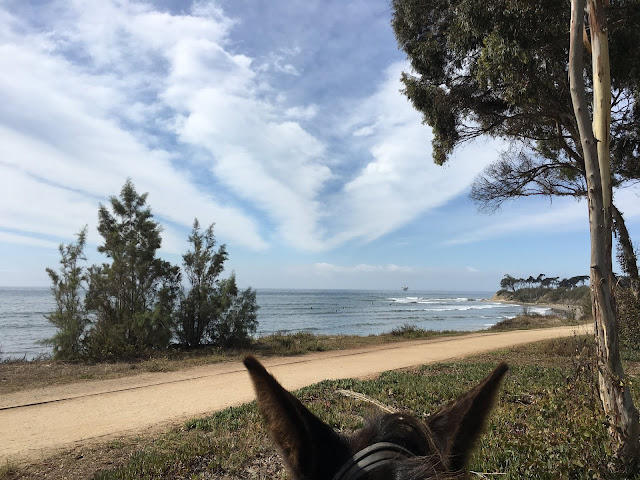
Then we stride on toward the cliffs and the beach overlook.
On the left is the edge of the student community Isla Vista, and far out on the path the first of the lads carrying surfboards that would present a challenge for Tobe.
The self-preservation instinct of mules is legendary, and today was the day he learned not to spook at surfboards.
On the horizon is one of the oil platforms, and on the sea below surfers hang ten.


At this point every time we saw surfboards Tobe would stop and take time to assess the threat.

He has keen eyesight, and this was a new shape and movement.
I love taking portraits of the people I ride with, it is a special gift I can give to thank them for accompanying me on adventures.
Here they are next to the Campbell Cross at Coal Oil Point Reserve, that has a knight on horseback at the bottom of the sculptured face.

This is a photo from a few years back of Tobe and I here, when the grass was greener.

This gardener popped up out of the bushes to ask what we were doing at the cross, and then pointed out something I'd never noticed before. He said the rumor is that Colonel Campbell was a Mason, and lo and behold there IS a Templar cross set in the bricks of the pillars at the entrance to what he said was once the graveyard.

There is also a very old conical dovecote built of stone, largely unremarked upon by the surfers heading for the beach below.

He said Colonel Campbell used to enjoy releasing the doves for his hunter friends to shoot.

How different times are. Nowadays we are not allowed to go onto the beach for fear of disturbing the snowy plovers.


Sad Tobe, he does love to run on the beach and enact the Black Stallion scene that all equestrians love to experience.
But not here anymore.
Like the honking geese above, we turned for home.
Another day in nature well spent, the perfect antidote for the highly detailed indoor hours that tattooing demands of me.

"I'm your biggest fan,
California,
I'm coming home."
- Joni Mitchell 

##########FIN ### PATFISH##########