Ventura River Preserve exploration
It was a hazy humid day with a breath of wind, and that sounded like a Good Day to see where a new trail into the mountains above Ojai would take us.
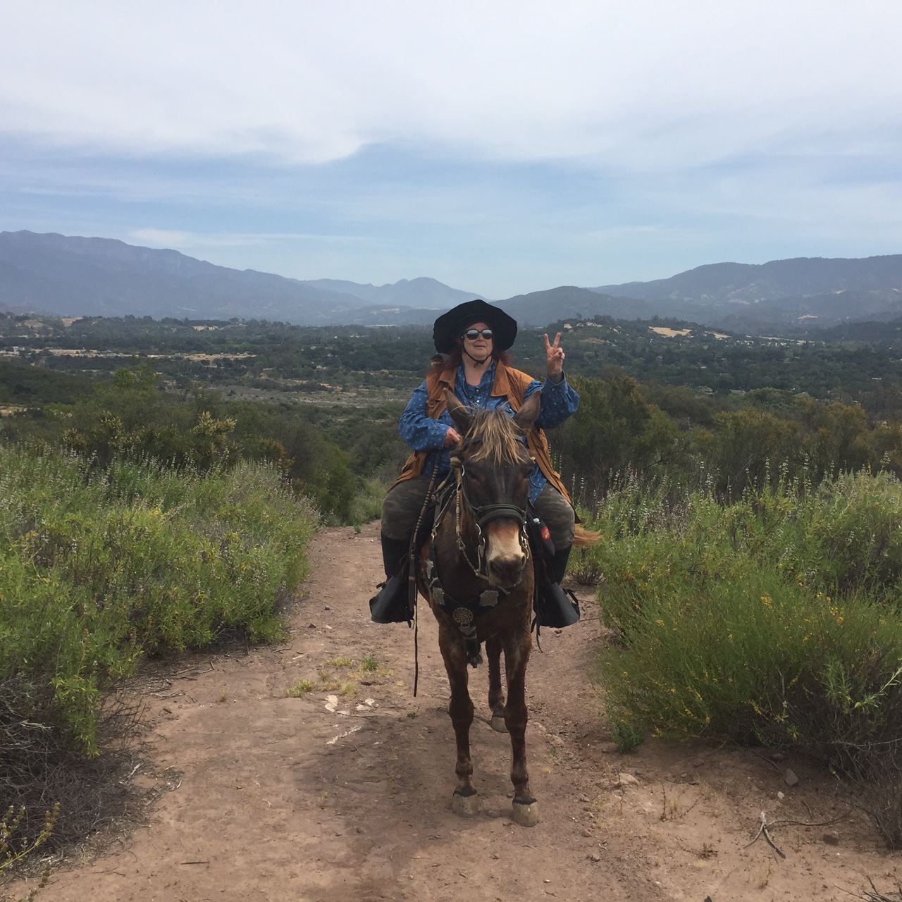
We started at the Oso Trailhead in the Ventura River Preserve, walked down the river (rocks and warnings of rattlesnakes, no water) and then headed straight West, up Copper Canyon, for what turned out to be an hour of straight up up up. Then we turned, and returned on Willis Canyon.
6.36 miles in 2:46, ascending from 580' to 1,272' and then back again.


Access to the Preserve is free, and is a very popular asset to the Ojai and Meiners Oaks communities. We saw quite a few other equestrians out on the trails, in the river bottom, but once we headed up to conquer the mountain we were on our own.


Nicely groomed soft trails let the animals get limbered up. We paralleled the river for a while, letting the day begin.


Tobe did his best to follow them, but sometimes he shook his head in confusion. Good thing he has those sturdy mule hooves.


To keep us from slipping over the edge we were sensibly contained by Bob's Fence.


Ananda was born to run, all Arabians are, so here she is practicing her Time Warp moves while Cowboy Bob poses for a photo.


Almost at the top of the ridge we saw this mysterious spiral pattern laid on the side of the trail in small stones. Mysterious sight...... no telling how long it has been here. The climb is pretty extreme, it was a strong hiker who made it all the way up here and then left this mark.

And not far along this rock cairn was tucked into the trees ....... Nature spirits worshiped here !
 The valley below is gridded up into pastures and agriculture, none of which are visible from the roads running through it. Rising up above it all shows how very productive and organized the landscape is. I especially like the curving way the trees at the left center are planted, so graceful.
I turned Tobe to take this shot of the valley below us and when I looked back at the photos I was so excited to see the speck in the sky. Could it be a condor, coming down from the Sespe Condor Sanctuary? Might it be a red tailed hawk, or even an eagle?
Nope.
Blowing up the photo I discovered it is a butterfly, just as amazing.


Along the trail convenient memorial benches have been placed, very inviting and well deserved by anyone who could climb this trail. Poor Tobe, at this point he was pretty darn sweaty and looked longingly as the bench, no doubt thinking if I got off for a rest he could have a snack on that luscious grass next to it.
But no.


And there are the rigs, and Tobe can be sure that there will be water, carrots, apples, and his human and saddle will come off and he can have a good roll in the dirt. That, to a mule, is compensation enough for having done all this hard work and taking me to the summit.
Then a ride back to his home on the coast, where it is a foggy hazy cool day and he can relax.
Until the next adventure!