It required a pre-dawn departure for me to be a part of this
BackCountry HorseMen of California sponsored trail ride, but it was an opportunity to ride on a historic Californio Rancho, the Chimineas, and I was determined to make it happen. So I packed up the MuleMobile the night before, fetched Tobe in the dark, and headed North.
The Chimineas is located 30 miles East of Santa Maria on Hwy 166. Once home to the Chumash Indians, a Spanish land grant sectioned it into a ranch that first saw early Californios driving cattle through the canyons. Homesteaders began building in the 1880s, and by the mid-20th century the property covered over 50,000 acres and supported over 8,000 head of cattle. This gate shows the brand.
Today a remaining 30,000 acres are an ecological reserve,
acquired by the State of California, Department of Fish and Game
with the assistance of The Nature Conservancy and the Rocky Mountain
Elk Foundation. The ranch is being developed as a center for ecological
learning and the enjoyment of nature. It links the
250,000 acre Carrizo Plain National Monument with the 2,000,000 acre Los
Padres National Forest, and hosts an extraordinary mosaic of habitat
types and biological diversity. To read more about the organization
that is managing the reserve click here:
Chimineas Ranch Foundation.
So I arrived early, and waited at the roadside for the others to arrive and watched the sun rise through this classic oak.
Then finally it was time to saddle up Tobe and hit the trail.
There were 3 mules and 4 horses along for the ride. Before we headed out we stopped at a stock tank to see if the animals needed a drink for the road.
Tobe and I got a slow start, but we actually like to follow in the back. I'd rather pay attention to developing my riding skills than chatter, and this was a landscape to savor. Plus he'd been standing in the mulebox for hours and needed a bit of time to start stretching his legs at speed.
But this grim trail marker was more than ominous. The cow skull still had brindle fur attached, and looked like a reminder of the drought that this area has been experiencing for the past several years.
Worse yet a rib cage and another cow skull..... what kind of ride was this going to be???
When you're not the lead dog, the view never changes. But these guys are seasoned packers, and they know these trails well. I'm happy to let them lead on and be a follower.
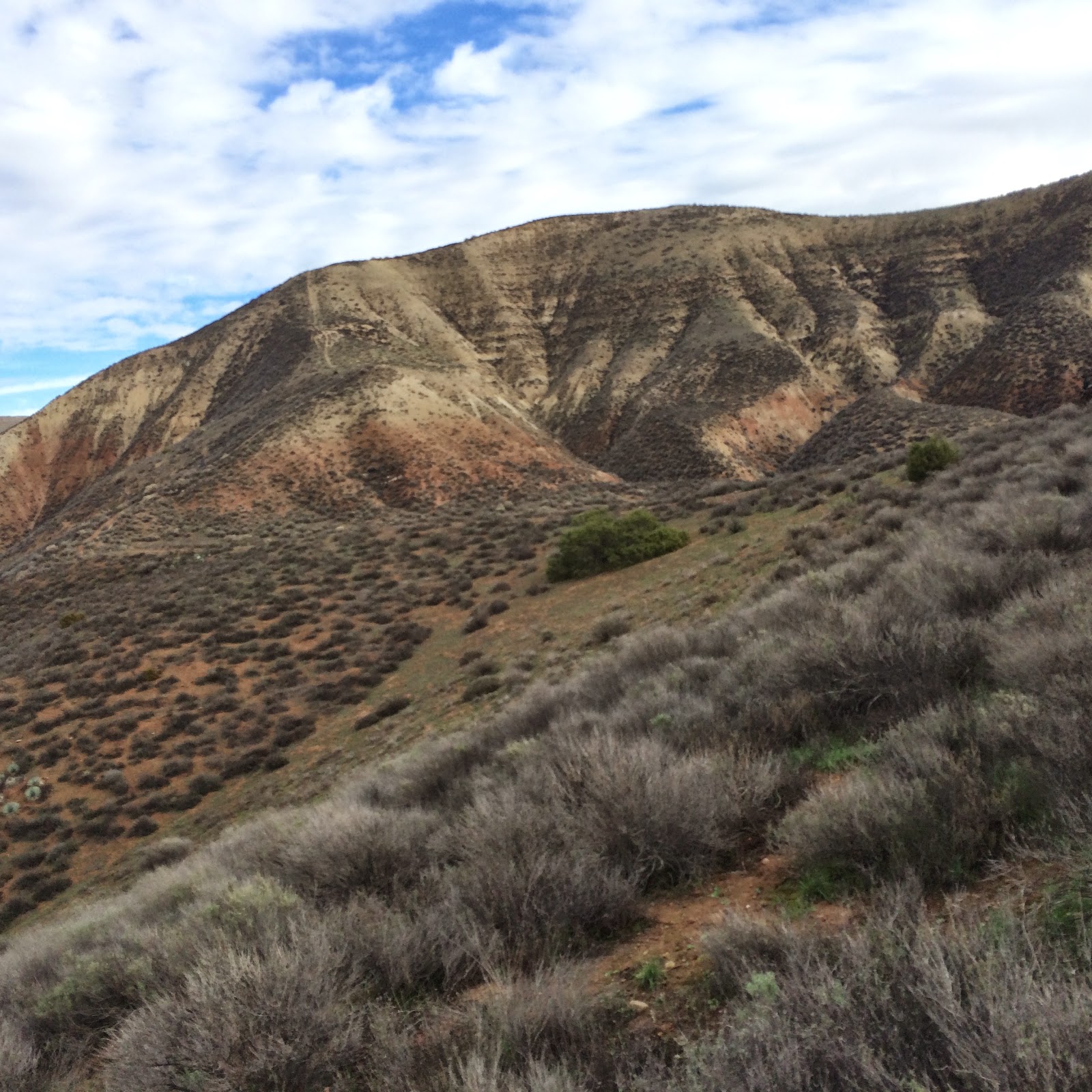
The landscape is so dry and desolate, with exposed rock everywhere, that it is more like a desert than the ranch with rolling hills and elk I had been expecting. Woodland grass covers the lower slopes, and buckwheat and sagebrush flow up the hills until near the tops only scattered yuccas cling to crevasses in the rock.
We were fortunate that a recent rain had soaked the ground, and brought out the red color in the mountainsides. Contrasted with the sagebrush it made a beautiful panorama.
But it could be harsh and unforgiving in the wrong conditions. In August 1979 the Spanish Ranch Fire claimed the lives of a fire crew from Nipomo who were dispatched to these mountains to fight a developing fire. The unpredictable winds that flow up and down the canyons, combined with the combustible grasses and dry brush, created a swift moving firestorm that overtook the firefighters as they tried to create a fire break line up the side of a hill.
None of the trail was very strenuous, mostly it looked like it was could be driven by 4 wheel drive vehicles.
Mule riders learn to interpret the language of the ears. In this case there is an irrigation pipeline in the brush to the right that caught his eye. At least that's what I THINK he is looking at, could be something I can't perceive. He's very alert. His right ear is turned back to me as I ask "What is it?" and his gaze is fixed focus ahead. With his enhanced eyesight he could be watching an animal on the slope across the canyon.
Beautiful geologic formations, and I was very grateful that we were doing this ride in January, not in the summer when I think this place would be an oven. Today's weather was cool with high clouds, perfect conditions for climbing dry canyons.
We had a goal to go back to a spring, and then come back out. So up and up we went, watching the topography reveal itself with canyons after canyons.
Finally, we got to Poison Spring.
The Trail Boss said that the cave in the wall has always had water in it before but it was dry now. He said at the best of times the water never seemed drinkable, more like something dead bats had fallen in. Can you read the mule ears? They said "Don't THINK about us going over there to investigate." His nose is 3 feet long, mine is 3 inches, so sometimes I know he can smell things from very far away. I didn't think we needed to smell dead bats up close.
Then again, the Trail Boss did say that sometimes homesteaders would name a perfectly good water source something like Poison Spring to keep other people from wanting to horn in on their territory. After all, who is going to drink the water to test the truth of the name?
These rocks placed in a rectangle under an oak are all that is left of a homesteader's cabin. Generations of people have come and gone from these canyons, eeking out a hard life from the land.
Some of the rock walls are a geological study, showing evidence of seismic shifts, and supporting yuccas and sagebrush and Mormon tea bushes, a scrubby kind of ephedra.
The gal walking her Arabian said he was getting tired of the footing and so she got off and gave him a break. The little mule following her is not even leashed, it just trotted along as if it were packing, but today it is free ranging.
Sometimes she and the little mule and her husband would leave the road the rest of us were following, and cut out across the trails on the sides of the canyons. The canyons are criss-crossed with cattle and elk paths, and possibly some of them lead up to the remnants of abandoned homesteads.
Just behind this ridge is "Dead Man Flat" which ought to be more accurately called "Dead Boy Flat" and is the scene of a sad story. A man stole some horses and brought them back to this canyon, and when he met up with a posse looking for them he told the pursuing "Coon Dogs" that the thief was just in the next canyon. The boy was his step-son, and he wanted him out of the picture so he could be alone with the mother. When the Coon Dog posse found the lad they strung him up and hung him from an oak tree. Only later was it discovered that the evil step-father was the real thief. Too late for frontier justice.

All over the property are giant water tanks, some newly installed, others like this one rusting away. But this one was still on the back of a 1950's delivery truck, and apparently came to rest and never made it into service. It is a major goal for the foundation that manages the property to increase access to water for the native species, and we saw evidence of their water lines and tanks throughout the ride.
We never did see anything larger than a squirrel but odds are there were lots of critters who saw US from concealed vantage points. There were meadow larks singing sweetly from the tops of scrub oaks, and hawks above. But overall the impression is one of desolate silence, huge landscape and a timeless quality of nature enduring. The wise guys said that the elk herds spend their days hunkered down in the canyons, and come out in the cooler evening to feed on lower slopes.
Then finally it was time to head back to civilization. Hours had passed, miles had been covered, and the rainclouds had started to sprinkle us. Time to call it a ride well done, an exploration well accomplished, and enjoy the memories of seeing a slice of the California past preserved relatively unchanged and timeless.
Title: Chimineas Ranch Track
Date: 1/10/15
Distance: 14.28 mi
Total Time: 5 hours 16 minutes
Moving Time: 3 hours 42 minutes
Stopped Time: 1 hour 34 minutes
Moving Speed: 3.8 mph
Ascent: 1,513 ft
Min/Max Altitude: from 1,424 ft to 2,147 ft
Started: 1/10/15, 9:38 AM PST
Ended: 1/10/15, 2:54 PM PST




 Posts
Posts


